Disclaimer:
This article represents the opinions of its author. The views expressed here are not necessarily representative of The Sunrise News staff as a whole.
I’m not sure how I haven’t written about this park yet. I’m talking about the tallest point in Alabama, the oldest continuously operating state park and it’s surrounded by one of my favorite national forests — the Talladega National forest near the end of the Appalachian mountains. Named after the Creek Indian name for the mountain, “chaha” — meaning high place — Cheaha state park is the quintessential park for Alabama outdoor enthusiasts.
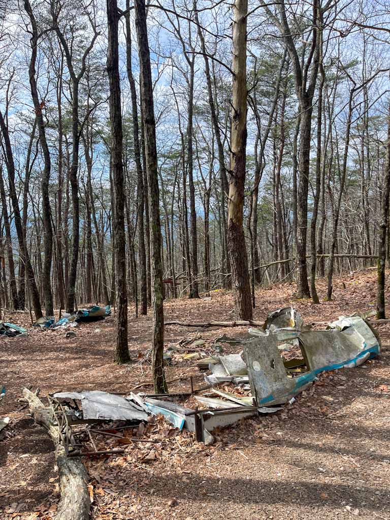
This is my second time going to Cheaha. My first trip was to McDill Point, an awesome trip with some of my close friends from the 4-H Center. Connected to the Pinhoti Trail, McDill Point features lots of switchbacks and has old plane wreckage along the trail. The gorgeous overlook at the end makes the moderate trek more than worth it.
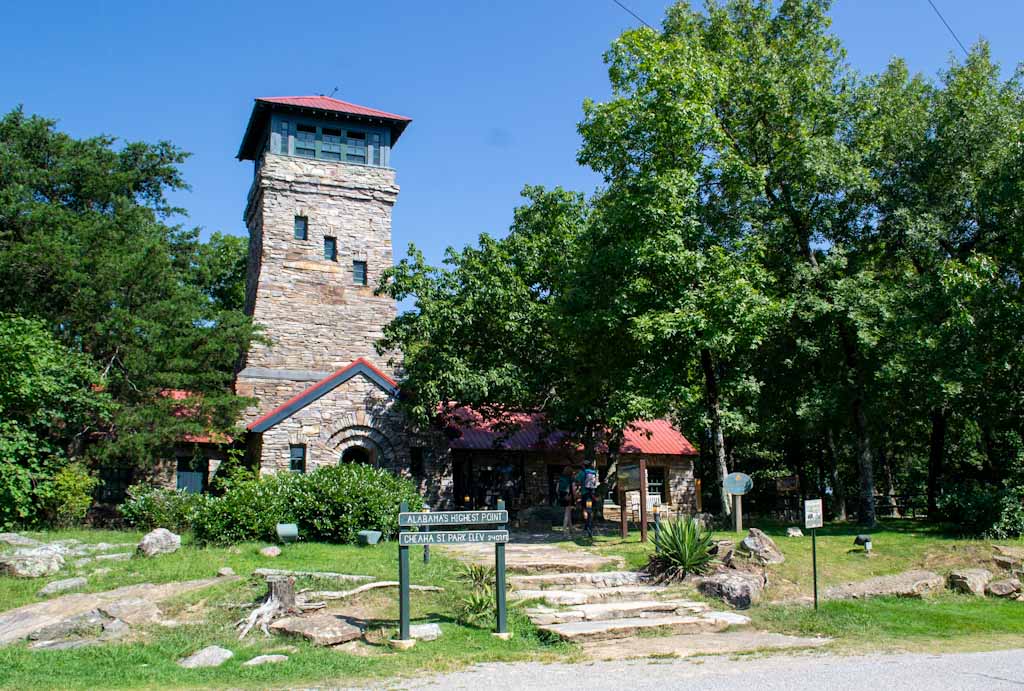
Although we planned to do McDill again for this second trip, having parked in front of the trailhead, we changed plans last minute. We ended up deciding to check out the highest point in Alabama — Bunker Tower, constructed by the Civilian Conservation Corps — followed by whatever else we found to do in the park. We played it by ear.
The Civilian Conservation Corps was part of President FDR’s New Deal. The CCC’s main goals were to conserve the natural resources of the United States while providing employment across the country. In Alabama, they helped build different infrastructure across the state including several of the state parks, like Cheaha.
At Cheaha, they built Cheaha Lake, Bunker Tower, Bald Rock Lodge, stone cabins and a stone bathhouse, all still in use today.
Our first stop was the welcome center outside the admission gate. We picked up some maps and bought some stickers. The welcome center also has plenty of camping supplies for anyone who forgot snacks, minor gear and other general hiking necessities. After stopping by, we paid the $5 per person fee and planned out what we wanted to see around the park.
From the entrance, Bunker Loop takes you to most of the main trailheads including Bald Rock Trail, Bigfoot Trail, Heritage Education Trail, Lake Trail, Mountain Laurel Trail, Pulpit Rock Trail, Upper Spring Loop and several other hiking and biking trails.
Many of the trails are no longer than two miles, with some exceptions, and also connect to each other or other parts of the park. Additionally, quite a few of the trails connect to the Pinhoti Trail. I mentioned it earlier with McDill Point, but the Pinhoti Trail is a 339-mile trail with its southern terminus and trailhead at Flagg Mountain, AL, the last southern Appalachian peak above 1,000 feet.
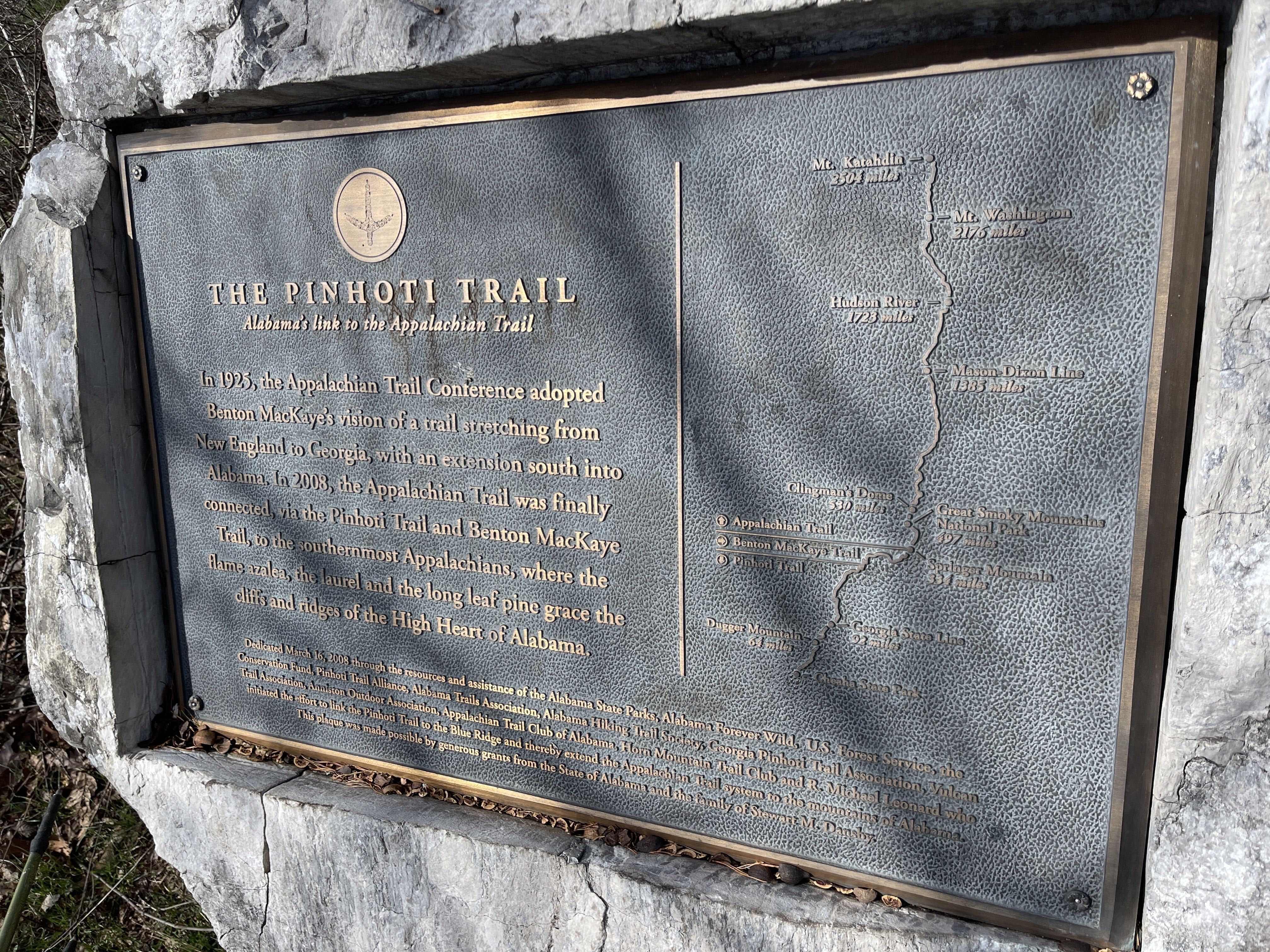
Its northern terminus is located where it joins the Benton MacKaye Trail in northern Georgia. The Benton MacKaye Trail, named after the man who is often credited with creating the Appalachian Trail, is also the connector for the Pinhoti to the AT. The Pinhoti Trail was largely created and established as an effort to realize MacKaye’s original vision of connecting the southernmost part of the Appalachian Mountains in Alabama to the northernmost point in Maine.
The Pinhoti also runs right through Cheaha State Park. It was fun to think that a trail I had been on in the Smokies could directly lead me to where I was currently at, albeit hundreds of miles through some of the most rugged terrain in the Southeast.
But, before we got close to the Pinhoti, we found our first stop — the highest point in Alabama—Bunker Tower. Bunker Tower was built by the CCC in the 1930s. At the top of the tower is an observation deck where we could see Alabama for miles. Unfortunately it was getting close to the afternoon and a lot of our views were covered in a haze due to the rising humidity. Regardless, it was still a surreal place to be standing in. After we came down, we wanted to go to the CCC museum connected to the bottom of the tower, but it was locked.
Around the base of the tower and in the surrounding area, there are also two trailheads: The Heritage Education Trail and the Bigfoot Trail. We didn’t hike these trails, but educational signs at both trailheads made them sound like promising, short distance treks.
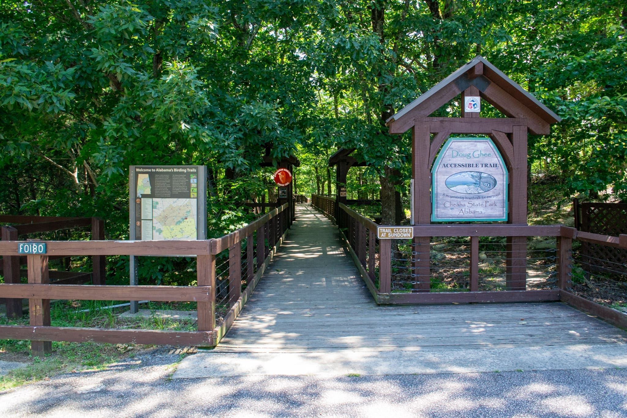
Instead, we continued through the loop and stopped at the Bald Rock Trailhead, located next to the Bald Rock Lodge. The lodge was beautiful with a stunning stone facade. Also built by the CCC, it is used for events and lodging.
The trailhead is next to a parking lot located by the lodge. With clearly marked signs and a building for bathrooms by the trailhead, it’s hard to miss. Approximately half a mile to the overlook, the trail also has an accessible boardwalk that leads to the Bald Rock Overlook. Along the boardwalk, there are plenty of benches and interpretative signs about the surrounding ecosystems.
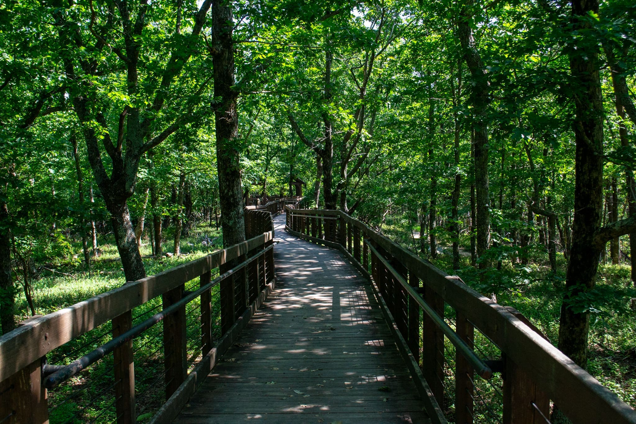
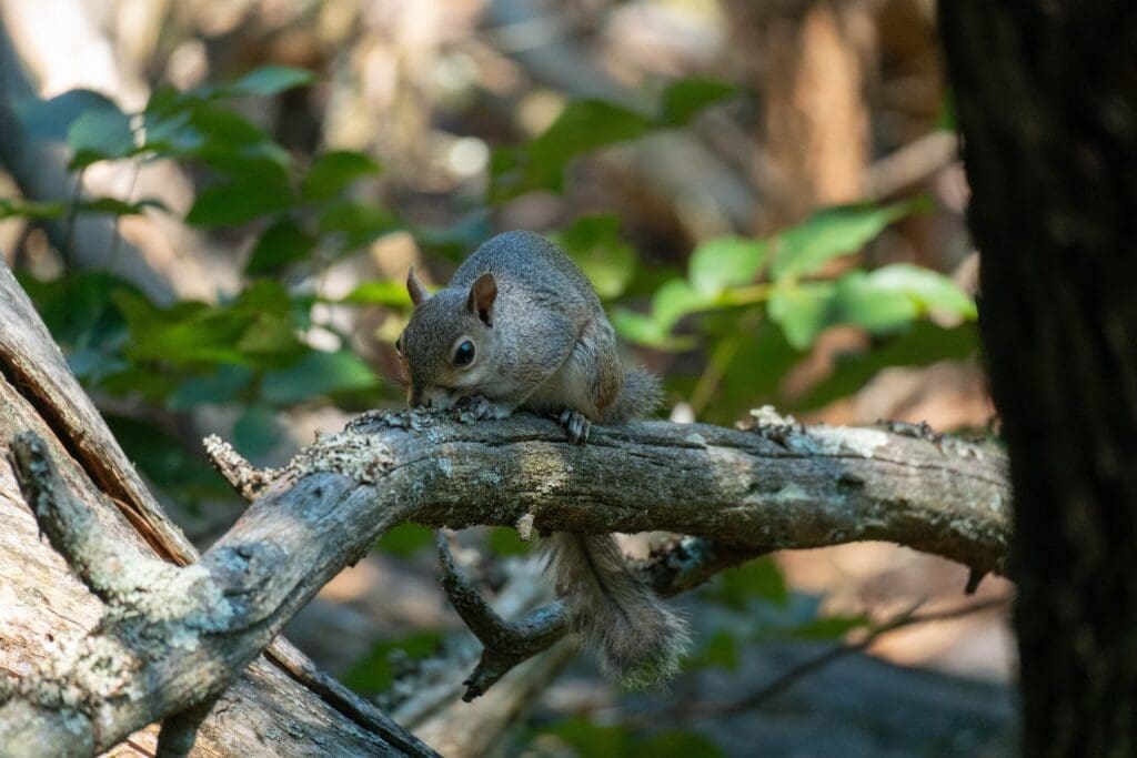
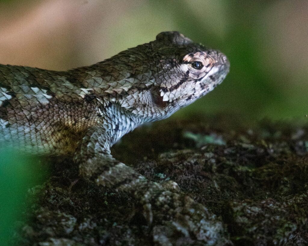
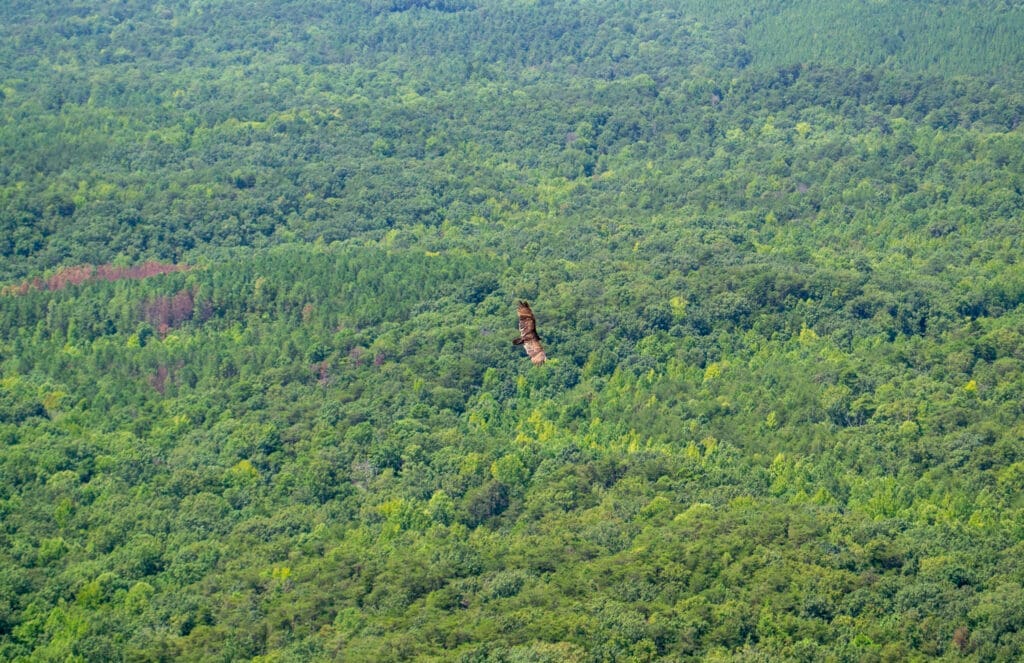
At the end of the trail close to the overlook, there’s a Pinhoti Trail connector that we explored for a bit. There were eastern fence lizards galore, some of them were decently sized for the small lizards Alabama normally has. While also an official Alabama birding trail, we only saw a few woodpeckers dotting the trees along the boardwalk and the occasional vulture while we looked out from the overlook.

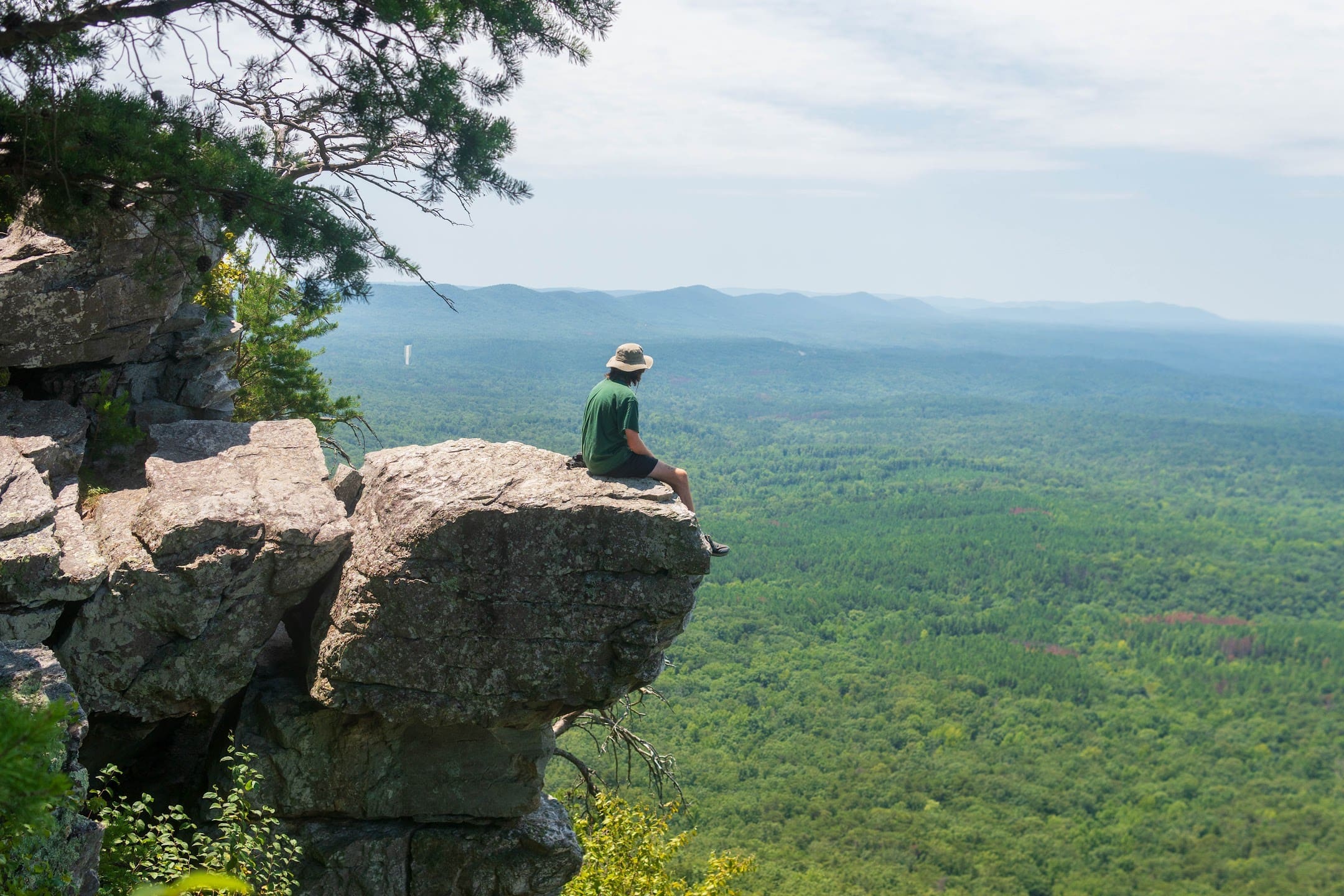
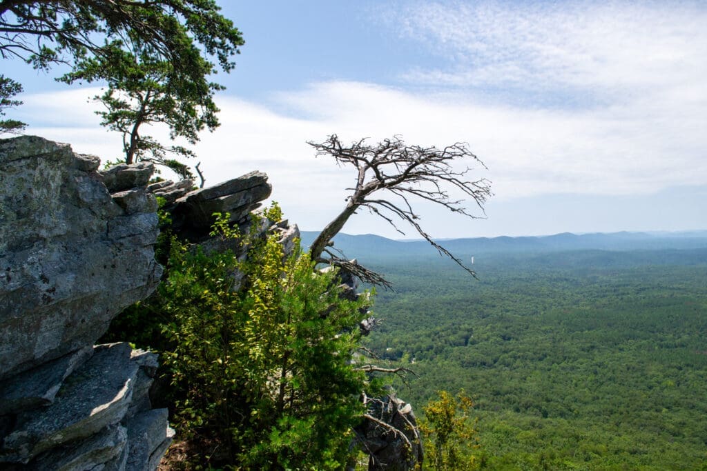
Eventually, we turned around and headed back towards our car for our next stop, which was Pulpit Rock. The trailhead here was in a small gravel lot with a clear sign for Pulpit Rock. This trail was also relatively short at about a third of a mile to the overlook but had much more elevation change than the relatively flat boardwalk at Bald Rock. Some of the terrain was a little rugged but the trail was solidly marked with red dots as trailblazers.
We spotted some more wildlife, including some more eastern fence lizards and watching the vultures and other birds riding heat thermals — rising hot air — made the overlook feel alive. Seeing more of the national forest below and less of the developed areas nearby, I think the overlook at Pulpit Rock is much better than Bald Rock. That is to say, Bald Rock is still 100% worth the short hike.
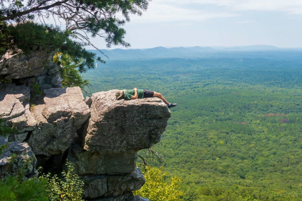
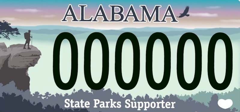
While walking around the outcropping boulders, we also became convinced that Pulpit Rock is the site that influenced the Alabama state parks license plate. They look almost identical. We looked it up and couldn’t find a conclusive answer, but here is a photo of me on the rock and the license plate — you can decide for yourself.
We also spotted some anchors around the area in the rock and immediately recognized them as sport climbing and rappelling anchors. Cheaha requires visitors to have a permit for climbing and rappelling, but is still a popular location for both activities.
As we finished our snacks and took in the views, we turned back around and made our way to the car. We had plans to also take a hike to see Rock Garden but ended up deciding against it. It was already late afternoon and the heat began to get to us. We were all low on water and satisfied with our time at Cheaha.
On our way out of Cheaha we stopped at the Cliffside Restaurant and overlook, but unfortunately the restaurant was closed. The overlook was still open, along with the pool right at the edge of the cliffside. From there we caught a glimpse of Pulpit Rock, and from that angle we all agreed it looked even more like the state park license plate.
After taking in one last view, we headed back to our car and left Cheaha.
This was my last hiking trip with my roommates before they left Alabama for the next chapter in their lives. I know I’ll see them again soon and our hiking days are far from being over, but if you’ve been keeping up with previous LLH additions, you might know that almost every hike I’ve done for the better part of a year now has been with them. Because of that, Cheaha State Park has another level of significance to me now.
So, if you’re looking for an easy time outdoors in Alabama but don’t want to commit to a full day of hiking, if you want to find a peaceful campsite with better views than your backyard or even start on the Pinhoti Trail, Cheaha State Park is an excellent place to choose.
While we didn’t find any crazy biodiverse wildlife or see jaw-dropping spectacles of massive waterfalls or large canyons, Cheaha may be one of my favorite places I’ve hiked in. Cheaha is reliable, has trails for all levels of hiking and contains one of the best glimpses of efforts made by the CCC to conserve and beautify our natural lands.
Author
Like our work? Then support it!

Want to get early access to columns, unique newsletters and help keep The Sunrise News active? Then support us on Ko-Fi!
Suggest a correction
Disclaimer:
This article represents the opinions of its author. The views expressed here are not necessarily representative of The Sunrise News staff as a whole.