Disclaimer:
This article represents the opinions of its author. The views expressed here are not necessarily representative of The Sunrise News staff as a whole.
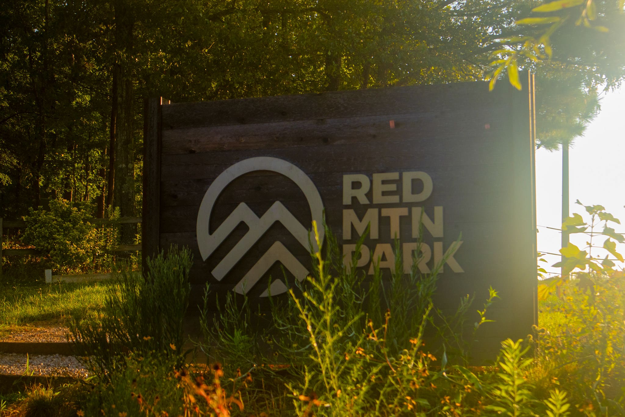
For as long as I can remember, I have loved being outside. Hiking is one of my favorite ways to spend my free time, so naturally, as a resident of Birmingham, I am a huge fan of Red Mountain Park.
Of course, there are several places in the Birmingham metro area to hike, but part of what makes Red Mountain appealing is the ease of its terrain. Red Mountain is a place I can go with friends who don’t hike much and feel confident that they will be able to handle the terrain. Also, it is small and the trail is immediately accessible from the parking lot, which makes it convenient for a quick morning hike.
A brief history of Red Mountain
Tucked away inside an industrial area in Homewood, Red Mountain might seem like a park out of place, but before it was a place of leisure, it played an important role in industry in Alabama.
Back in the 1800s, hematite ore deposits were discovered on the land that is now Red Mountain and, by the mid 19th century, it had become a well-developed mining site. The site was closed in the 1960s, but was preserved thanks to community conservation efforts. The park opened to the public in 2012.
Eventually, the Jefferson County Greenways Foundation and Commission was formed to manage and maintain Red Mountain Park alongside Ruffner Mountain and Turkey Creek Nature Preserve. The foundation is a non-profit entity that handles outreach and education and is able to raise private funds, while the commission owns the land and is able to access public funding.
“What this does is it poises us to be able to manage all of the large acreage green spaces that get developed in the future in Jefferson County, as well as these three assets that we have today,” explained Janet Simpson, the greenway’s chief operating officer and deputy director.
If you’re interested in learning more about the history of Jefferson County Greenways, their work and the people involved in it, then make sure to check out the latest Alabama Spotlight episode coming out this Thursday!
Hiking Red Mountain
There are two entrances to the park: one by Venice Road and the other on Frankfurt Drive. Typically, I take the entrance by Frankfurt Drive, just off Lakeshore Parkway. There is a small gravel lot that you can pull into there, though if that lot is crowded, people will park along the road leading up the park.
As you walk up, you’ll see some picnic tables, shipping containers turned into office spaces and a map kiosk. Things might look a little different than what we have pictured below, because the park is working on building universal restrooms at the Frankfurt Drive entrance for 2026.
You have to travel a minute or two down the trail before you come to the intersection that opens you up to the majority of the trails, though you can reach the dog park from the entrance pretty quickly. I recommend that, before you progress down the trail, you take a picture of the map. No matter how easy the hike, you always want a map. Ideally, you want a printed map, but a phone works as long as you don’t run out of battery. Red Mountain has both Spanish and English versions of their map at the map kiosk, which is great, but make sure you take a picture of the one you can read. I accidentally took a picture of the Spanish map, and since I can’t read much Spanish, it created a few moments of confusion for me with figuring out which landmarks I was hiking towards.
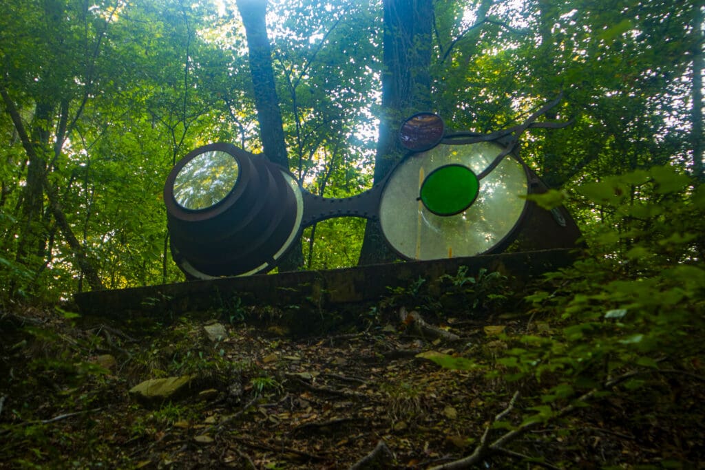
Past the entrance, the trail opens up into an open space with a few trail options, picnic tables, a map kiosk and some really nifty giant spectacles, created by MESH Collective Art.
There are several interesting routes you can take at this point. If you take the L&N Trail you can head towards the Butler Snow Sensory Trail, which is pretty cool and would be a good way to keep any kids you might have with you entertained. I actually walked the full trail for the first time a few weekends ago with Wesley Hyde, our digital media specialist.
I’ve visited a few different sensory trails at other parks I’ve been to, and I think this might have been the biggest one I’ve seen. I particularly liked the fact that they included a place for you to sit down and take a break.
From there, you have a few options. If you want an easy trek with relatively flat terrain, then you can head west down the BMRR South Trail. Personally, I prefer to walk along this trail for a little, then take Smythe Trail up to the Ike Maston Trail. This trail is a little steeper and provides a little bit more challenge if you aren’t used to hiking.
From here, you can head southwest until you reach the Redding Trail, then take it to the #10 Mine Trail. From there, it is easy to reach the EBSCO overlooks, which presents a fun view. They also have some giant chairs and a hammocking area near the overlook which can be a fun place to stop and relax. There isn’t a lot of shade though, so it isn’t the best area to stay too long on hot summer days.
The connecting trail ways at Red Mountain actually form a loop, so if you felt so inclined, you could do a circuit of the whole thing in 5 or 6 hours, depending on how quickly you hike and the route you take. Personally, I typically go to Red Mountain either with friends or for a short morning hike, so it isn’t often that I travel more than 5 miles while out there.
There is a second entrance to the park by Venice Road. If you take the route I’ve described so far, then you leave the Ebsco Overlook and head to the Wenonah Connector, which you’ll hike to the BMRR North Trail. Once there, you’ll head in a generally southwest direction down the trail to Venice Road.
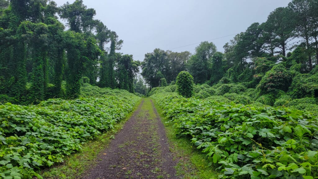
Walking along the BMRR North Trail to the entrance was one of my favorite parts of my recent trip. As you walk, you’ll hit a place where the trees open up and the entire area has been absolutely consumed by kudzu. I know the plant is an ecological disaster for native plant life, but man, it sure does look pretty.
The Venice Road entrance is a little smaller than the one on Frankfurt, though it has a fully paved lot instead of gravel. It also is where Red Mountain Park connects to the Jones Valley Corridor; a group of interconnected trails in Birmingham. The connecting trail between Red Mountain and the rest of the corridor is the High Ore Line Trail.
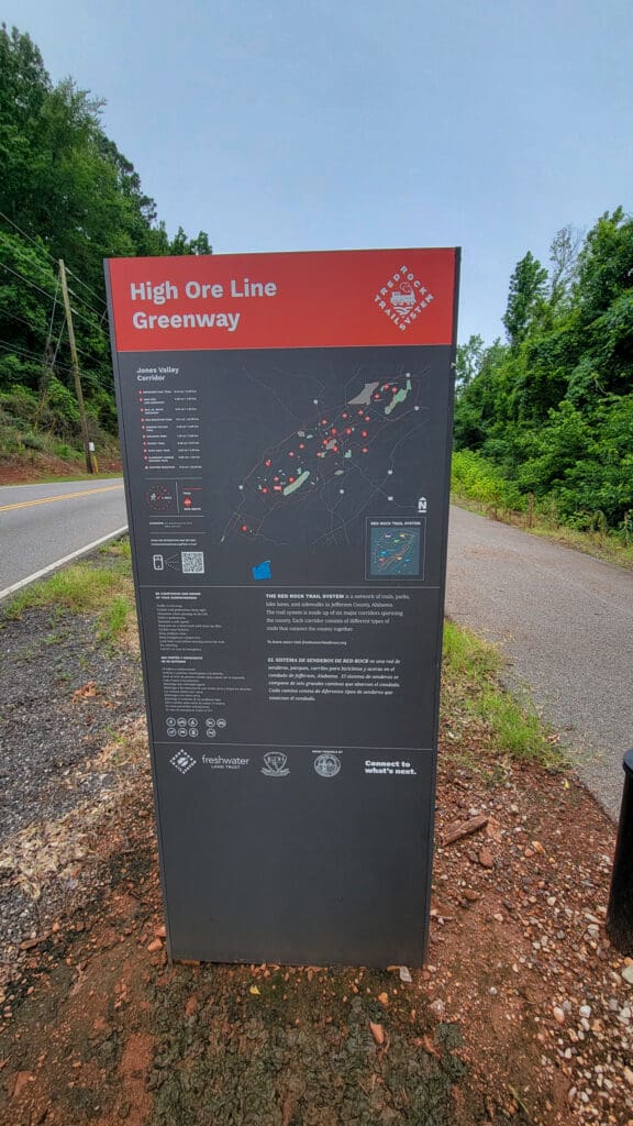
The Jones Valley Corridor is a part of the Red Rock Trail System, a network of trails, parks, bike lanes, and sidewalks in Jefferson County, Alabama. For one of my New Year’s resolutions next year, I am planning to hike the entire system. I’ll make sure to write about the experience, so hopefully that is something for readers to look forward to!
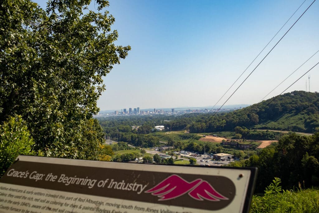
As I said before, Red Mountain forms a loop, so from the Venice Road entrance you can hike along the BMRR North Trail, then hop onto Shook Trail and hike until you get to Grace’s Gap. From here, you get a pretty good view of Birmingham.
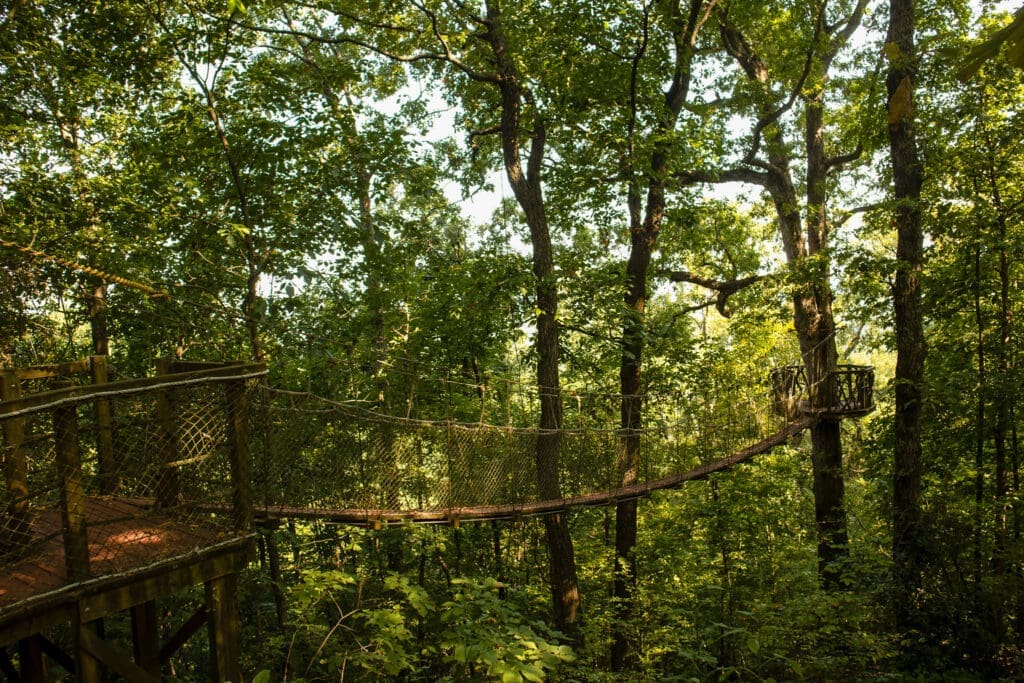
Either along the way to or coming back from Grace’s Gap, you should make sure to stop and check out Riley’s Roost along the BMRR North Trail and the treehouse along the Ike Maston Trail.
I recommend keeping your hands free for the treehouse’s rope bridge. I think trying to navigate that bridge with our gimbal was Wes’s least favorite part of the trip.
Structures at Red Mountain
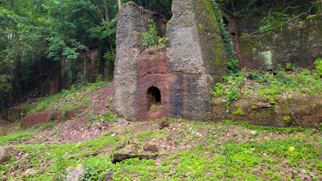
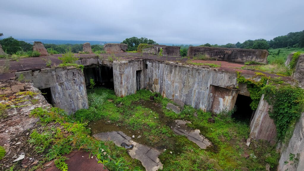
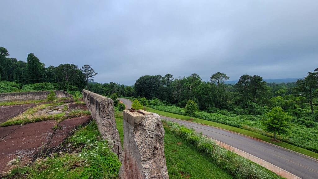
There are several historical structures still present at Red Mountain, remnants of its industrial past. The vast majority of these structures have clear signage informing visitors to keep off. I assume this is both for visitors safety, and to preserve the structures for the future.
One exception is the Protective Life Corporation Picnic Area, which has picnic tables set on one of the old building foundations.
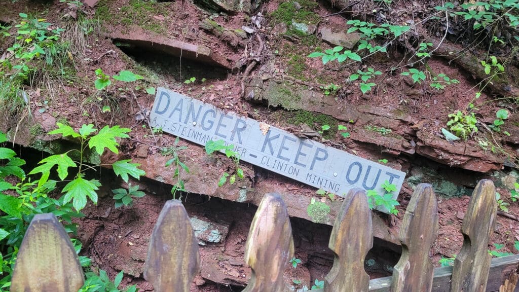
I thought I’d found another exception by the Venice Road entrance to the park. There is an old building overlooking the parking lot, and a trail that makes it easy to reach the top. I went up and climbed up.
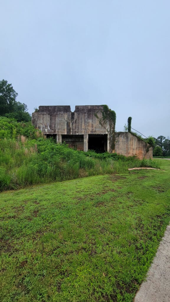
It was an incredible view, but as you can see, there definitely were some dangerous spots up there. In fact, while I was up there and looking about and taking notes for this article, I included one about how surprised I was that they didn’t warn people to stay off this structure. Naturally, after I moved back onto the trail and looked through one of the decaying windows, I spotted the sign.
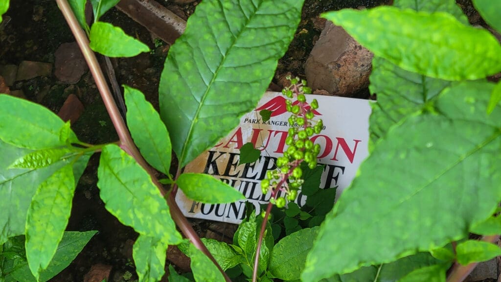
So, yeah, if you do go through the Venice Road entrance, stay off that structure. And, in general, unless you see clear signs that you are meant to go onto it, like the picnic table area, then I’d advise staying off them, both for your safety and to keep from damaging them for future visitors.
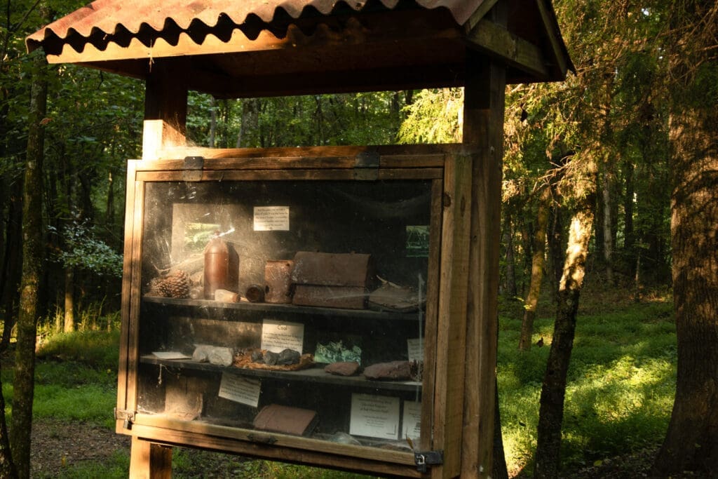
As you explore Red Mountain, you’ll find many of these foundations have signs near them, explaining what they used to be and sometimes showing old photos from before they fell into a state of ruin.
In addition to the historical structures, Red Mountain also has several places where outdoor exercise stations have been established. Given how many people use the trails for running, it wouldn’t surprise me if a few of the stations see regular use.
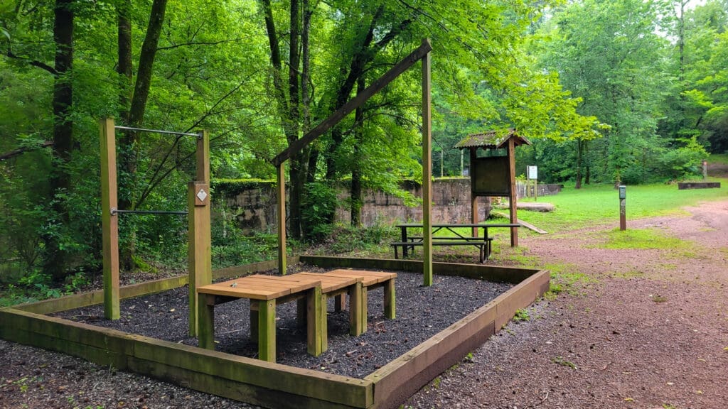
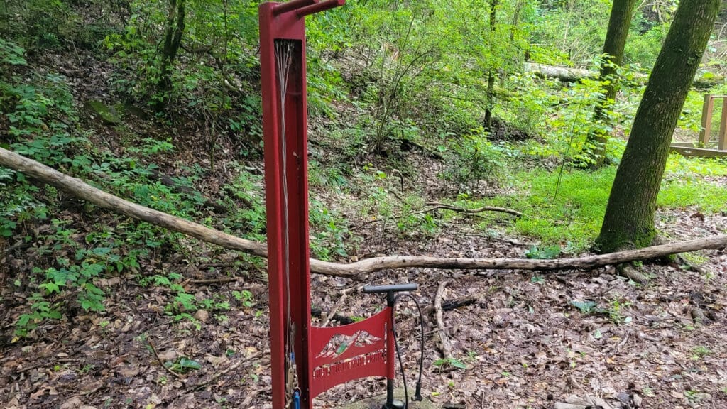
There also are several bike stations, set up with tools chained to a post and bike pump. I really like this as a concept, and every time I walk past one it makes me regret the fact that I haven’t been mountain biking in years. That being said, the condition of these stations does tend to vary. Some are in good shape, but a few have rusted tools and the pump at the one pictured no longer worked. Still, there is enough that the stations could still be useful to someone if they have a bike emergency while at the trail.
I consider Red Mountain a solid option for any outdoor enthusiast. It has easy trails for beginners, while still providing a good enough challenge to work out more experienced hikers. Additionally, the historical aspects of Red Mountain provide a unique opportunity to learn more about Alabama history in a fun, hands-on way.
It’s great for day hikes because of its size and the large number of interconnected trails making it easy to plot a short trip, but it also has the ability to provide an all day excursion. Any Alabamian that enjoys hiking should add Red Mountain to their list!
Updated on Jan. 16 to change Ruffner Mountain Nature Preserve to Ruffner Mountain and correct a typo where the Jefferson County Greenways had been referred to as the Red Mountain Greenways.
Author

Like our work? Then support it!

Want to get early access to columns, unique newsletters and help keep The Sunrise News active? Then support us on Ko-Fi!
Suggest a correction
Disclaimer:
This article represents the opinions of its author. The views expressed here are not necessarily representative of The Sunrise News staff as a whole.